The coldest, possibly snowiest period for many years is currently being churned out by the computer models. But how likely is it and whats causing it?
I’m sure you’ve heard of “Sudden Stratospheric Warming”, it’s been shouted about across the media and weather organisations in the past week or so. Falling air in the Arctic Stratosphere compresses and this causes it to rapidly warm.
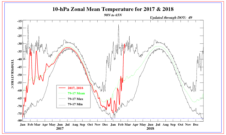 The red line is the Stratosphere temperatures through 2018 and so far this year, the green dotted line is the average. The red line suddenly shooting upwards is the Sudden Stratospheric Warming.
When this happens, the Polar Vortex, a series of low pressure systems circling the Arctic keeping the cold air “locked up” collapses, splits and dramatically weakens, high pressure in the Artic replaces low pressure and we see the cold air spilling out into mid latitudes, our latitude.
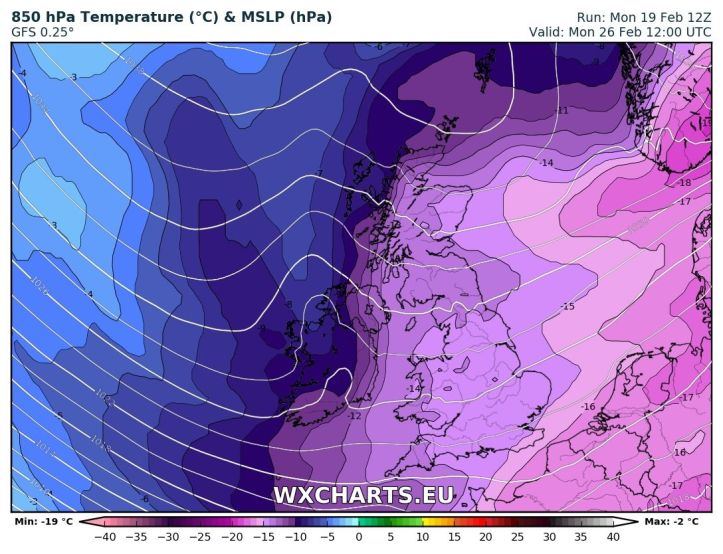
The models are predicting high pressure over Scandinavia allowing bitterly cold Easterly winds to set up by the end of next weekend/into early next week.
But. It’s weather, it changes, the computer models can often get things wrong. How likely is this? Well, confidence is high and we’re around 90% certain this is going to happen now.
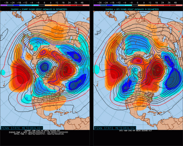
The chart above shows the ECM on the left and GFS on the right, two forecasting models. Both have high pressure to the North of the UK (orange) and low pressure to the South (blue). Both are fairly identical in terms of pressure placement so we can have more confidence because the models are agreeing.
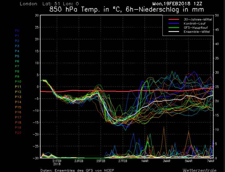 The above are the GFS ensembles. Temperatures are down the left hand side and the date along the bottom. Each line is an ensembles which on their own are useless but when used as a group, can give a clearer idea of whats to come.
Around the 24th/25th we see this drop massively down to -14c, these are temperatures about 1000 feet up but they show just how cold the air is. For perspective, the red line running across the middle is the average for the time of year. 2009/2010 a very cold winter didn’t see uppers below -12c, so this cold is likely to rival those cold spells.
Conclusion & Forecast:
This week will be rather settled with high pressure largely dominating, turning colder with frosts as the week progresses. Temperatures by the weekend largely 5-6c across the country, colder in the East.
Through the weekend and into early next week we start to see very cold air moving across the North-Sea towards the UK and this will generate heavy snow showers across Eastern and South-Eastern parts.
Now, this is a big IF but if we see a “direct hit” from the cold air like the models are currently showing, we could see snowfall totals in the range of 20-30cm quite widely, locally up to 50cm where showers are frequent and streamers set up. There’s a LOT of uncertainty around snow/where/how much but there is the potential, and at this stage that’s all it is, potential for a very severe, snowy period of weather early-mid next week.
